Difference between revisions of "Ship trap"
S.tikkanen (talk | contribs) |
|||
| (8 intermediate revisions by 3 users not shown) | |||
| Line 1: | Line 1: | ||
| − | '''Definition''' | + | '''Definition |
| + | ''' | ||
| − | + | Ship traps are maritime hazards or underwater obstacles, which lead to an accumulation of accidents and thus an extensive collection of shipwreck sites.<ref>Delgado (ed.) 1997, Encyclopaedia of Underwater and Maritime Archaeology. British Museum. pp. 377</ref> | |
| − | ''' | + | '''Artificial ship traps''' |
| − | + | Strategic chokepoints of navigable waters such as narrows or rivers were blocked to obstruct the movement of enemy fleets. One of the earliest examples in the Baltic Sea is in Skuldelev, where Viking Age vessels were scuttled to block a navigable channel.<ref>O. Crumlin-Pedersen & O. Olsen, The Skuldelev Ships I, Ships and Boats of the North 4.1. (Roskilde, 2002)</ref> | |
| − | |||
| − | + | '''Natural ship traps''' | |
| + | |||
| + | Examples of natural ship traps are reefs jutting into narrow straits, or treacherous shoals. Several ship traps have been marked as BalticRIM priority areas. | ||
| + | |||
| + | In Finland, one ship trap is located in the Jussarö Gaddarna archipelago, where several shipwrecks are known and dated to the 18th and 19th centuries.The area was known for magnetic anomalies that disturbed the compasses due to the high iron content in the bedrock. This anomaly is first mentioned in Lucas Waghenaer’s special map depicting the archipelago in the Gulf of Finland published in 1584 and has been marked in navigation maps since then. Modern archaeological research has designated the area as a so-called ship trap,a sea area where environmental and cultural factors work together to create a dangerous area for the passing ship traffic. | ||
| + | |||
| + | In Schleswig-Holstein, Germany, the Puttgarden reef is a natural ship trap, with a shoal extending deep into the Fehmarn Belt strait, a major traffic artery. | ||
| + | |||
| + | Generally, ship traps form into maritime areas with heavy traffic and which natural conditions facilitate shipwrecks. Environmental factors related to shipwrecks include currents, wind and wave conditions, liability to storms and underwater reefs or shallows. Cultural factors related to ship traps are navigational routes, which direct maritime traffic. Connected with the suddenness or variability of the prevailing conditions, which make it hard for mariners to prepare for them, these factors facilitate accidents. The shipwrecks in ship traps are conglomerations of many poor factors. | ||
| + | |||
| + | |||
| + | [[File:Balticrim jussaro metsahallitus FHA.jpg]] | ||
| + | |||
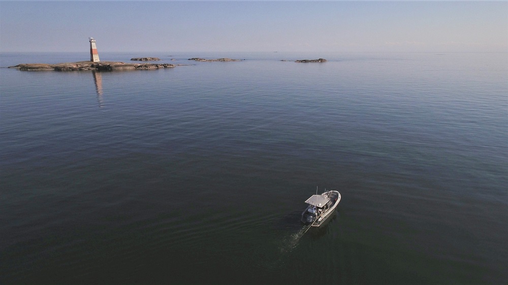
| + | The Jussarö ship trap next to the Sundharu lighthouse in Finland. Photo: Jesse Jokinen, Finnish Heritage Agency | ||
Latest revision as of 15:57, 30 December 2020
Definition
Ship traps are maritime hazards or underwater obstacles, which lead to an accumulation of accidents and thus an extensive collection of shipwreck sites.[1]
Artificial ship traps
Strategic chokepoints of navigable waters such as narrows or rivers were blocked to obstruct the movement of enemy fleets. One of the earliest examples in the Baltic Sea is in Skuldelev, where Viking Age vessels were scuttled to block a navigable channel.[2]
Natural ship traps
Examples of natural ship traps are reefs jutting into narrow straits, or treacherous shoals. Several ship traps have been marked as BalticRIM priority areas.
In Finland, one ship trap is located in the Jussarö Gaddarna archipelago, where several shipwrecks are known and dated to the 18th and 19th centuries.The area was known for magnetic anomalies that disturbed the compasses due to the high iron content in the bedrock. This anomaly is first mentioned in Lucas Waghenaer’s special map depicting the archipelago in the Gulf of Finland published in 1584 and has been marked in navigation maps since then. Modern archaeological research has designated the area as a so-called ship trap,a sea area where environmental and cultural factors work together to create a dangerous area for the passing ship traffic.
In Schleswig-Holstein, Germany, the Puttgarden reef is a natural ship trap, with a shoal extending deep into the Fehmarn Belt strait, a major traffic artery.
Generally, ship traps form into maritime areas with heavy traffic and which natural conditions facilitate shipwrecks. Environmental factors related to shipwrecks include currents, wind and wave conditions, liability to storms and underwater reefs or shallows. Cultural factors related to ship traps are navigational routes, which direct maritime traffic. Connected with the suddenness or variability of the prevailing conditions, which make it hard for mariners to prepare for them, these factors facilitate accidents. The shipwrecks in ship traps are conglomerations of many poor factors.
The Jussarö ship trap next to the Sundharu lighthouse in Finland. Photo: Jesse Jokinen, Finnish Heritage Agency
